Monday 29 February 2016

Missing posts

Daily posts missed twice in succession.  I’ve been crook!  How crook?  I’ve been as miserable as a crab in boiling water…..  Now that we have the excuse and plea for sympathy behind us let’s move on.

Jan rather liked Northwich but the CRT pump out machine was unserviceable and we wanted to empty the tank. Consequentially our time on the River Weaver was going to be cut short.P1020404

The High Street

There was an interesting building on the left at the top end of the High Street.  OK… maybe it don’t look particularly interesting.  But it was the wording above the entrance that caught my eye.

P1020411P1020410

“Brunner Public Library and Salt Museum AD 1909”

Brunner Public Library?  But we are in Northwich!   After some searching….. well actually I noticed the poster on the wall whilst drinking a pint in the Wetherspoons pub opposite!  John Brunner was a wealthy local chemical industrialist who was also a Member of Parliament. 

Wikipedia states

In 1873 Brunner formed a partnership with Mond and together they founded Brunner Mond & Company. Their initial capital was less than £20,000 (£1.6 million in 2016), most of which was borrowed.[ In April 1872 Mond had been to Belgium to meet Ernest Solvay to negotiate terms to manufacture alkali by the process Solvay had developed. The Solvay process produced soda ash more cheaply than the established Leblanc process, from raw materials which were more easily obtainable, and produced fewer waste products. Mond made a gentlemen's agreement with Solvay to apportion the global markets, with Mond's company having exclusive rights to the United States and to the British Isle.    You wouldn’t get away with that type of cartel today!

There are more interesting facts in the above wikipedia link.  I did note his first wife had six children in their ten years of marriage before dying.  I guess she was worn out.  The following year he married his children’s governess and had three more children by her.  He was a generous benefactor in the local area and overseas.  The public library and salt museum were founded with funds he supplied.

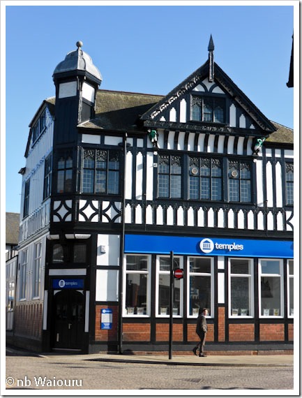
There was another interesting building at the opposite end of the High Street near the river.

P1020407

An unusual looking small turret on one corner but what I had noticed were the two small figures under the ends of the facia boards on the large gable.

P1020408P1020409

I haven’t identified why they were present!  Oh, this is a photo of The Penny Black pub in Northwich.  It’s the local Weatherspoons.   There is a plaque to the right of the main entrance stating it used to be the Main Post Office.

P1020412

We didn’t have Sunday lunch there. Actually we didn’t have a Sunday roast lunch this week.  Reader Bill informs us Wetherspoons are to shortly cease including the Sunday roast on the menu.  One more microwaved meal we will miss! Smile

Saturday 27 February 2016

A gentle slide down

This morning we moored on the boat lift moorings at 11.30 where we were joined by nb Kookaburra for our descent down the Anderton Boat Lift to the River Weaver.

IMG_8968

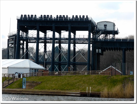
When we first passed this way the boat lift was closed due to corrosion.  It was subsequently restored after a major fund raising effort.  The lift takes boats between the Trent & Mersey Canal and the River Weaver in two large caissons.  The descent is approximately 50 feet.

This part of England has a long history of salt extraction and associated industries.  The product was moved by vessel down the River Weaver and from there onto the River Mersey.  The subsequent construction of the Trent & Mersey Canal above the River Weaver offered another transport option and the opportunity to send product to Stoke on Trent and beyond.  A large interchange basin was constructed which included an inclined plane and salt chutes.  Eventually these were identified as a ‘choke point’ and the Weaver Navigation Trustees started looking for alternatives.  They attempted to get the North Staffordshire Railway Company, owners of the Trent and Mersey Canal, to ask for a contribution towards the cost of building the proposed boat lift, but this was refused.   The Trustees then decided to fund the boat lift on their own.

IMG_6353

The original lift consisted of two cast iron water filled caissons which were joined to the canal by a cast iron aqueduct.  The lifting method was a water hydraulic system which consisted of a 50ft ram under each caisson that was 3ft in diameter.  The caissons worked in opposing directions (one up and one down) which meant only a small steam engine was required to move the caissons.  This system worked until the beginning of the 20th century at which time it was discovered the water powered system had caused serious corrosion.  The system was then modified to work using electricity.  The structure was strengthened by the addition of ‘A’ frames on either side and a system of gears and cogs were fitted on top.  Heavy counter balance weights were also added.  The electrical system was a success and the cost of maintenance was subsequently reduced.  By the 1970’s commercial traffic had ceased and the boat lift was almost exclusively used by recreational craft.  In 1983 extensive corrosion was found and the lift was closed.  It reopened in 2002 after a £4m restoration that took 2 years.

The operating method has reverted back to hydraulic rams.  Except these are now oil powered instead of water thus minimizing the potential for corrosion.

More information here

Whilst we waited the two CRT operators arranged for two boats at the bottom of the lift to come up. The first step was to raise the two guillotine gates at the base.  The first gate seals the dry dock and the second is the entrance to the caisson. 

IMG_6359

Once these are raised the two boats could enter the caisson and both gates were then lowered.  Hydraulically operated chocks are withdrawn which seals both gates.  The exterior gate is sealed by the water pressure from the river and the caisson gate by the water pressure inside the caisson.

IMG_6362IMG_6368The second boat was a fibreglass CRT patrol boat. 

Once both the boats had been raised and had exited the lift NB Kookaburra led the way onto the aqueduct.  But first the lift operator had to raise the guillotine gate at the canal end.

P1020414

We followed and both boats were then on the aqueduct stopped in front of the caisson.  At this point the aqueduct and caisson guillotine gates were closed.

P1020417

Waiting on the aqueduct

P1020420

The aqueduct guillotine gate was then lowered behind us sealing the aqueduct off from the canal.  The operator then opened the interconnected aqueduct and caisson guillotine gates allowing both boats to enter the caisson.

The two gates were then lowered behind us.  There is a small gap between these two gates which is full of water.  This is drained off which allows the water pressure from the aqueduct and caisson to seal each gate.

IMG_8970

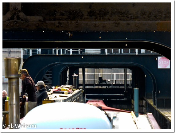
Looking up it is possible to see the now redundant gears and cogs of the electrical system.  The cables and counterweights have been removed.

The trip down took approximately 10 minutes and exiting the lift was the reverse of the entry.

P1020435

Oh….. the title of today’s post has nothing to do with our trip down the boat lift!  This evening I was sitting in my captains chair when the rear weld on the central swivel under the base slowly fractured tipping the seat forward slowly depositing me onto the floor.  I’ve considered having the swivel re-welded however in the interest of safety I think a new chair is required.

Friday 26 February 2016

The opposite direction

Today we decided to walk in the opposite direction. However before doing that son and I walked south along Winnington Lane.  This took us over the River Weaver via Winnington Swing Bridge.  This area consists of a number of large chemical plants.

IMG_8945

Winnington Swing Bridge

IMG_8944

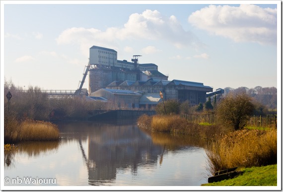
Almost all these plants appear to be derelict and in the process of being demolished.  This map extract shows the canal and River Weaver.  The red arrow points to the location where the industrial plants are being demolished and the land prepared for residential housing.

redevelopment 

IMG_8946

The one above was on the northern side of Winnington Lane and also appears to be derelict.  This next photo shows the other side of the large plant in photo 2 above.

IMG_8948

The demolition and remediation of the are can be seen in this next photo.  I wonder how heavily the land was polluted and just how well the remediation has been done.  Will the new home owners know or even check?

IMG_8949

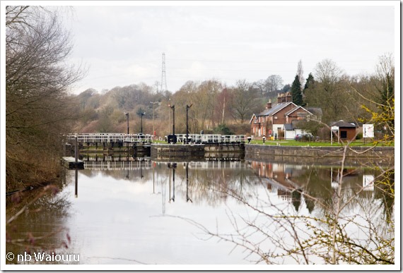
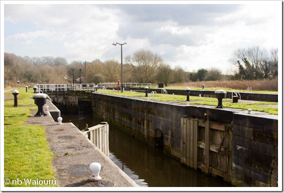
From here we walked back to the River Weaver and along the path beside the river to reach Saltersford Locks.  The river has obviously been used by some large vessels in a previous life.  The size of the bollards, locks and swing bridges are the most obvious clue.

IMG_8953

There are a number of attractive mooring spots between the Anderton Boat Lift and Saltersford Locks.  It’s very quiet and rather rural.  There were only three boats moored on the entire stretch.

IMG_8954

It was near here that we had a meeting with a CRT lengths man.  I was surprised to hear this stretch is walked at least once every month.  He usually walks 10km a day recording the state of the infrastructure and moored boats.  His electronic data recorder creates a permanent record of his movements and times.  His vehicle is also fitted with a data recorder.  Actually two men share the vehicle. One employee started at point A and walks the 10km to point B.  The second employee drives to point B and starts walking to point C.  When employee 1 reaches the vehicle he drives to point C to collect his colleague.  

IMG_8955

Saltersford Locks

Land access to the locks is via a SS Bailey Bridge.

IMG_8960

The CRT employee had informed us all the swing bridges are operated once per month to check they work, however the only time they are operated for traffic was for the yachts based in the marina upstream of Northwich.  Commercial traffic ceased a number of years ago after the industry that employed the coasters was asked to contribute to the maintenance of the bridges.  They must have made a commercial decision that transporting product by land was a more cost effective option.

The locks are paired and have a third set of gates in the middle.  There are signal posts at each end of the locks, although I’m not sure whether they are still operational.

IMG_8958IMG_8959

Now here’s a small puzzle.  Why are all the birds perched together on this rail rather than spreading themselves out across both locks?

IMG_8957

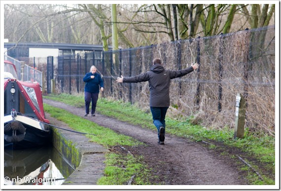
From here it was a short walk up the access road to the canal towpath and then back to Waiouru.  The small boy saw his mother beside the boat and happily ran to greet her.

IMG_8967

Thursday 25 February 2016

Northwich Walk

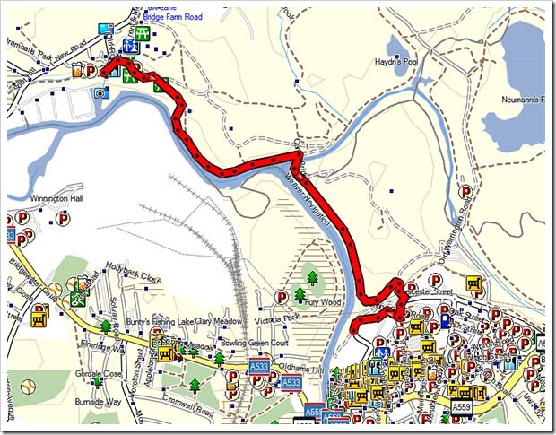
Well here we are on the Trent & Mersey Canal at the Anderton Boat Lift waiting for passage down to the River Weaver on Friday.  Some supplies were running low and as a consequence a reprovisioning walk to Northwich was planned.  The route took us along the eastern bank of the river.  The return distance was approximately 10km.

Weaver walk

At 9.30am I telephoned CRT and booked our passage down the Boat Lift.  To our surprise both caissons were at the top of the lift.

P1020397I had assumed the weight of each caisson countered the other however the CRT employee informed me they work independent of each other and only one caisson would be used on Friday.

There is a minor path at the base of the lift which joins the main path to Northwich.  However we couldn’t use it as the Anderton Boat Lift is currently closed and the gate at the bottom is locked.

P1020413

Looking back to the Boat Lift showing the minor path beside the riverbank.

The path between Anderton and Northwich is well defined with a firm surface and is well utilized by local walkers.

P1020399

Another look back at the boat lift.  We will see more of it on Friday.

P1020400P1020401P1020403P1020398

The first half of the walk takes you through the Anderton Nature Park.  This is former industrial land which has been remediated and converted to a nature reserve.  The unusual soil conditions have resulted in some rare flora growing in the park.  The second half of the walk skirts the edge of Carey Park which, with the adjacent Anderton Nature Reserve, forms part of the Northwich Woodlands.  Wikipedia has more information.

As we got closer to Northwich we could see a large new building was under construction.  It has a sawtooth roofline and a car ramp which led us to believe it’s a new shopping complex.

P1020405

A view of the new complex from the opposite side

The local barber confirmed it is a new shopping complex which will include an Asda supermarket and cinema complex.  I wonder what effect it will have on the existing bustling Northwich High Street.  The town already has four supermarkets so competition is likely to get fiercer.   We did our shopping in Sainsbury’s before retracing our steps to the boat.

Wednesday 24 February 2016

Pukeko

Last time we passed this way I didn’t pay much attention to the large industrial complex which spans the canal around Lostock.

P1020388

This time Jan noticed the sign “Tata Brine Concentration”. It appears this is another British industry owned by an Indian company

P1020392

A scaffolding crew were erecting a serious amount of scaffolding around the plant on the right bank of the canal.  The Tata sign increased my curiosity and after a little research I discovered the brine is extracted from underground wells at Warmingham which is south of Middlewich.  A pipeline conveys the brine to the salt plant at Middlewich where it is partially processed.  Another pipeline takes the partially processed brine to the Tata plant at Lostock for final processing.  The major product is soda ash.  There is approximately 15km of pipeline.  More information here

Just beyond the Tata plant is a boat brokerage where we noticed nb Pukeko.

P1020394

Most New Zealanders are very familiar with the Pukeko or swamp hen.  They are a very cheeky bird and when frightened tend to run rather than fly.  I had assumed they were native to NZ but have also seen them in Australia.  Some have suggested they are tasty in a stew.  I caught one many years ago and boiled it in a pot of with two large stones.  When the stones were soft I threw away the pukeko and ate the stones……..  Yes, they taste really bad! Smile

It was shortly after passing nb Pukeko that we came upon a loose stop gate.  It was against the bank but swung out as we passed brushing Waiouru’s side.  I couldn’t see how it was secured and had to leave it loose.

P1020395

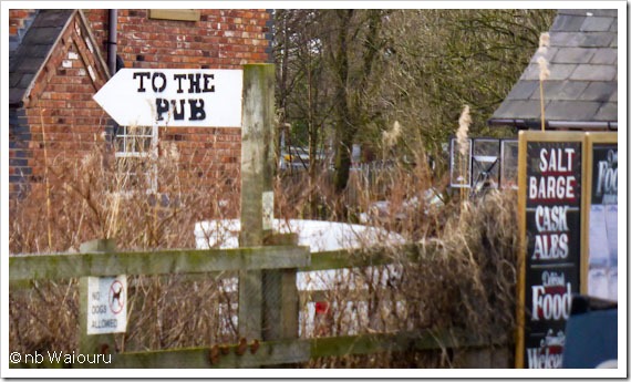
The visitor moorings at Salt Barge looked rather full.  I guess the nearby road and pub are the primary attraction.  Jan liked the sign.

P1020396

We carried on finding a vacant mooring opposite the ABC marina at Anderton.  But not before a short stop at the nearby CRT facilities to dispose of our rubbish.   We may go down onto the River Weaver.

Tuesday 23 February 2016

Moving on

The plan was for the two males on board Waiouru to visit the local barber this morning and then we’d start cruising further north.  The first problem was the shop was closed and the second occurred as we were dropping the pram cover in preparation for moving.  It started to rain heavily in small solid white lumps.  Cruising was deferred for 30 minutes whilst we waited for the black cloud to pass.  Jan then went forward to set The Big Lock whilst youngest son disappeared inside to do some work.  It must be great to have a job that can be done from anywhere in the world where there is internet.  Conversely, having to work when there are other, more interesting distractions, must sometimes be a curse.  We were seen off by the locals

P1020366

Four boats and a canoeist passed us in the opposite direction during our cruise.    We met the second boat immediately prior to one of the three flash’s we passed.  The steerer warned us there were some breasted working boats ahead and she ran aground trying to pass them.

P1020367

There are good and secure 48 hour moorings on the off-side about a kilometre beyond the first flash.  Jan took a photo into the sun after we had passed.

P1020371

However it was the following sign which particularly caught her eye.

P1020370

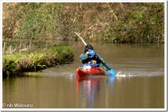
We then met the canoeist who subsequently passed us again on the way back to his starting point.  He was old with a long grey beard and looked cold and stiff.  Or perhaps I was looking at my reflection! Smile

P1020373

Then we reached those CRT working boats.  I carefully manoeuvred around them at tick-over thus avoiding running aground. 

P1020376

We did wonder why they had been left breasted up and then I realised the cabin hatch was open on the outer boat.  Jan had a quick glance at her watch and realised the workers were probably having lunch. 

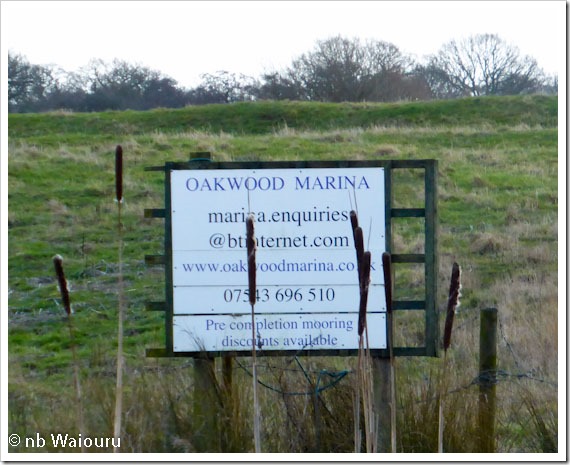
The cruising was quite pleasant during the periods when there was no wind and the sun was shining.  At other times it was darned cold!  The middle flash had the same marina sign we’d noticed when we were last this way in 2014.

P1020378The local farmer plans to build a huge marina in the flash. I checked the website and it doesn’t work.  The original advertising was for an opening in Spring 2014 but at the moment it looks like this……

P1020380Another marina project bites the dust….

A little further north you can see some progress has been made with the second local marina project.  Last time we passed by the marina had some finger moorings but the site was dry.  It’s now in water.

P1020382

No boats

P1020383

The entrance has been completed and two men were working on the opposite bank making and installing gabion baskets which will be used to construct a retaining wall to prevent erosion.

P1020384

Our elderly spritely grey distinguished canoeist passed us here although we subsequently caught up with him at The Old Broken Cross pub where he was removing his canoe from the canal whilst simultaneously attempting to unlock his frozen joints.

P1020385