Tuesday 29 November 2016

St Andrews

When standing beside our mooring on the embankment at Merry Hill and looking northeast you can see in the distance a woodland covered hillside with a church on the top.  That seemed a good destination for a walk with the possibility of panoramic views from the churchyard.  I should have taken a photo before leaving as it was dark by the time I returned.

st AndrewsChurch on the hill 

The route out followed the canal as far as the far end of the BCN Two Lock Line.  Along the way I stopped to read one of the historical signs.

IMG_1131

From there a narrow lane took me up the hill to the churchyard.  There was no view from the top because the summit was surrounded by a ring of trees.

IMG_1133

Unlike other walkers, I didn’t see the ghost whilst walking up the hillside. <more info here>

The church is St Peter’s of Netherton (Anglican) and is the most prominent in the area.  It was opened in July 1830.  I found it interesting that the church main entrance is at the opposite end to the driveway.

IMG_1134I assume the driveway was a late addition with most of the early congregation walking to church from the surrounding area.  Apparently Netherton has a significant number of nonconformist churches.  Mostly Baptist or Methodist.  Perhaps some time in the 19th century a significant proportion of the local Black Country population became disillusioned with the mainstream churches?

The route back to Waiouru was a wide arc avoiding the canal whilst attempting to stay on the high ground.

IMG_1137

St Andrew’s to the south

IMG_1139

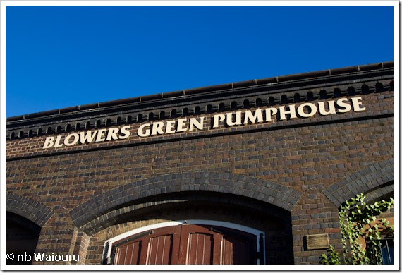
The road took me behind the Blowers Green Pumphouse.

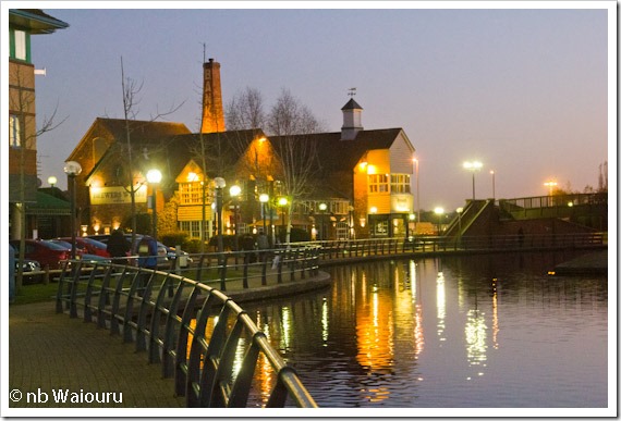
It was dark by the time I reached the Waterfront Basin.  Wetherspoons was open and doing some trade but The Brewers Wharf was closed.  Actually The Brewers wharf Is looking rather rundown with peeling paintwork and rotten facia boards.

IMG_1142Brewers Wharf

Monday 28 November 2016

Another year

Boat license renewal time again.  Why does every major bill come at Christmas?

It was a pleasure to use the CRT online renewal system.  Straightforward and simple….. which is more than I can say for the bank and it’s direct debit system.  They refused the payment pending a confirmatory telephone call to me.  Of course the call never came, which just added complexity to the process.  But it’s now all done and we’re again carefree!

So here we are once again moored on the embankment above the large Intu shopping centre at Merry Hill.  In front of us is nb Areandare with Barry & Sandra aboard.

P1030593

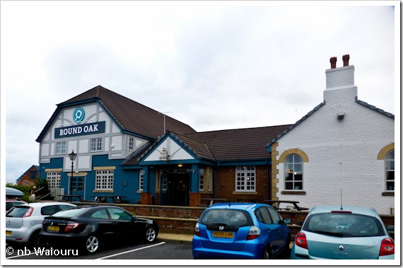
Sunday lunch was at the nearby Round Oak carvery (rated 8/10).

P1030594

Jan had a brief browse through The Range buying me some yoghurt sachets and an egg timer for Christmas. Smile  Generosity should be reciprocated and I bought her a litre of oil for the generator.  Now she will be able to do that oil change.

Saturday 26 November 2016

BCN Two Locks Line

Attempting to describe this mornings trip down the weed hatch as damned cold would be a serious understatement.  It was also a painful reminder not to put off until tomorrow what you can do today.  The water temperature would have been higher when we moored yesterday afternoon.

The item we collected going through Gosty Hill Tunnel yesterday was a large grey sheet of heavy plastic.  The type you might see on a building site.  It was wrapped around the prop and shaft before being bound in place by fishing line.  Whilst I dislike removing carpet and plastic from the prop it’s the fishing line which creates the most concern.  Immersing your hands in cold water quickly makes them numb and you never know if there’s a sharp hook on the end of the line.

The plan for the day was to move from Bumble Hole to Merry Hill.  We’ve moored there on two previous occasions and the adjacent large Intu retail complex does provide at least one of us with some retail therapy.

The Dudley N02 Canal is a contour canal with one lock taking you down to the Dudley N01 Canal at Blowers Green.  Along the way we passed the former entrance to the BCN Two Locks Line.

P1030589 BCN Two Locks Line to the left

This was a short cut between the Dudley N01 and 2 canals.  The original route can be seen on the extract from Paul Balmer’s Waterway Routes map below.

BCN Two lock line

We stopped at Parkhead Junction (Blowers Green) to dispose of our rubbish and top up the water tank.  The latter had been done yesterday but we know there is no water at Merry Hill so wanted to moor there with a full tank.

IMG_1129

The Dudley N01 Canal continues up the three Parkhead locks to reach the southern end of the Dudley N01 Tunnel.  Most boats won’t fit through the tunnel and passage for those that will fit is supervised.  The Black Country Museum is at the other end.

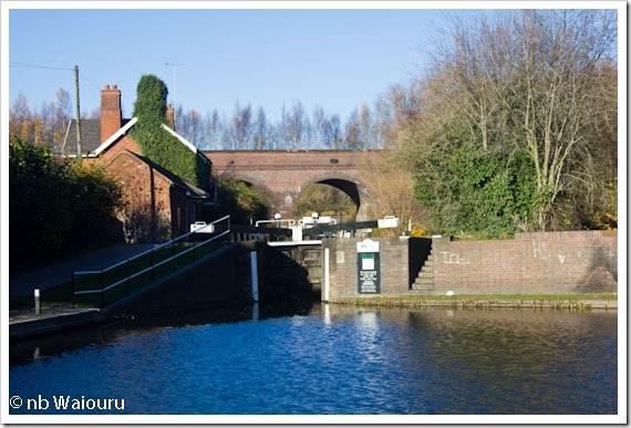
We turned left into Blowers Green Lock with the former pumphouse on our left

IMG_1130

When we first passed this way I had assumed the purpose of the pump house was to remove water from underground mines.  However everything I’ve read suggests it was used for back pumping water from the lower canals up to the main level.

We then passed the other end of the BCN Two Locks Line on our way to Merry Hill.

P1030592

Friday 25 November 2016

Back up

Well the nautical term is going astern.  With the forecast of a reasonably fine day a decision was made to reverse back to the water point and top up the tank.  There is a small canal side cafe and shop here which caters for the local walkers.  Jan had a good chat with a couple of local walkers whilst the tank filled.  Stopping on the water point also enabled us to remove the diesel stove flue. 

IMG_1123

After that we would go further astern to the junction of the Netherton Branch and Dudley N02 Canal where we turned SE down to Hawne Basin. 

We’ve been down to Hawne Basin on a previous occasion but didn’t bother to enter the basin as the brick bridge at the entrance looked very low. 

gosty hill

From Waterway Routes

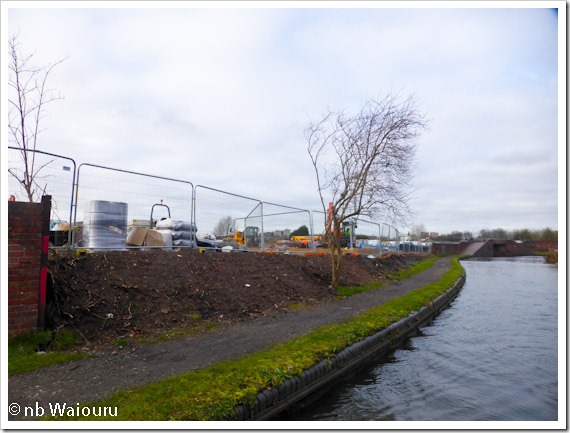
This time the canal looked much more pleasant.  New residential housing is being constructed on a brownfield site at the Bumble Hole end.  I think this land was either derelict or industrial on our last trip.

P1030573P1030574

Silhouette steel figures explaining the history of the canal can be found located alongside the towpath.

P1030575 

The remains of the brick toll office at the Bumble hole end are heavily covered in graffiti. 

P1030576At the next bridge we came upon two specialist graffiti removal contractors hard at work.  I suspect they are wasting their time and clients money.  Our experience in Adelaide is that graffiti must be removed very promptly.  If removed quickly and regularly those applying the graffiti give up.

We eventually reached the ‘narrows’ on the approach to Gosty Tunnel.  Despite only being on tick-over we came to a grinding halt with no forward or reverse.  There was something very serious around the prop.  Whilst I hated the idea of delving down the weed hatch into the damned cold and dark water I was grateful it had occurred before we entered the tunnel.  Eventually I was able to remove a large piece of carpet from around the prop.

P1030577

Stopped here

P1030579

The offending item

Gosty (Gos as in gossip and ty as in tea) Tunnel is just over 500 metres long and starts off with a high air draught.  About 50 metres inside the roof height drops considerably.  We guessed it had started to collapse and the height was reduced by the relining.  The new arch is painted which reduced the likelihood of hitting your head.

P1030580

After another 50 metres the roof rises back to it’s original height before dropping down again at the far end.  The trip through seemed to take ages, but then we were doing tick over.

P1030586

There was a sign on the canal retaining wall advising it was the location of Stewarts & Lloyds.  At one time they were one of the largest tube makers in England

IMG_1128

During WW1 and WW2 they switched to manufacturing ammunition.  They also manufacturered much of the ‘PLUTO’ fuel pipeline under the Channel which supplied the Allied invasion forces.

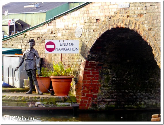
It’s a very tight turn into Hawne Basin with a low brick bridge over the entrance.
P1030582

You can see that not every boater makes it into the basin without hitting the bridge.

P1030583

The bow thruster is most useful in situations like this! Smile

We moored on the services mooring with the bow facing south-west.  The lady from the shop suggested we turn because the fuel hose wouldn’t reach the stern.  Everything became clear when we explained there were diesel tanks at both ends.  Once the bow tank was full we winded to fill the two stern tanks.  Diesel was 51ppl (domestic).  We bought 13Kg of calor gas £23 and had a pump out for £8.01.  

IMG_1127

The Trust have a covered slipway and if I remember correctly hire is £100 per week.

 IMG_1125

The entrance in the distance with the winding hole immediately beyond.

After parting with some of our hard earned money we made a right turn and lined Waiouru up on the bridge hole.

P1030584

The successful exit strategy was to drift through the bridge hole stopping in the winding hole where we would pivot to the left to go back up the canal.

The turn went well but we picked up something nasty on the prop inside Gosty Tunnel.  I wasn’t going down the weed hatch again and we persisted with the unwanted object around the prop all the way back to Bumble Hole where we moored.  It will be a task for tomorrow! Sad smile

Thursday 24 November 2016

Bumble Hole Walk

It’s been a cold and damp day so we only went for a short local walk.  One of the moored boats left this morning.

P1030563

The chimney of Cobb’s Engine House can be seen on the skyline in the above photo.  It was constructed to pump water from the local underground mines which was then discharged into the canal.

British pubs often have interesting and unusual names, today we saw the most unique name we’ve seen to date.

P1030564

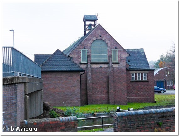
On the way back to Waiouru Jan noticed a building on the opposite side of the canal.  Initially, we assumed from the shape that it was a church.  However there was no cross on the top of the gable, it had a chimney and the shape of the bell on the roof suggested it was a school.  But a school would usually have more windows?

P1030565

After looking at the map I’ve identified it as St Peter, Darby End, Dudley.  It’s CofE and that’s about all the information I could find.

Wednesday 23 November 2016

On the move

After two rather miserable days of driving rain and wind it was almost a pleasure to wake up and find a dry and overcast day.  We moved the short distance down to the junction, reversing back onto the services to dispose of the rubbish and top up the water tank.  It was last filled eight days ago and the gauge was bouncing round ¾ full.  The water pressure was OK but it still took quite some time to fill.  Whilst we were on the services mooring a CRT Hopper and Tug came out of the Ocker Hill Arm and headed towards the Ryders Green Flight.  They were obviously going to be ahead which meant all the locks would be against us.
Once the tank was full we set off for the bottom lock (Lock 8) on tick-over.  That seemed a safe option given all the rubbish in the water.  The plan was to moor in the pound between locks 8 & 7.  There were no issues at Lock 8 but we couldn’t get Waiouru against the edge to moor in the pound.  Too many submerged shopping trolleys from the nearby Asda supermarket (the reason we wanted to moor).
We could see the CRT boats ahead at Lock 7.  They were having to bow haul the hopper into each lock and then work the tug up.  Jan walked forward to work Waiouru up through Lock 7 whilst the CRT crew were leaving for Lock 6.  She mentioned the problem we had in the pound and was informed they had a very difficult time with the hopper.  The crew were rather frustrated about the condition of the pound as they had only cleaned it out in May.
P1030561
Lock 8
We stopped for an hour on the Lock 7 mooring bollards making four trips to Asda for supplies and also having lunch.  Neither of us particularly like stopping on lock moorings but with no where else to stop and no other boats on the flight we thought it would be OK.
The rest of the flight didn’t present any problems.  So the problem hot spot is the pound between locks 7 and 8.  Asda need to think of additional measures to secure their shopping trolleys.
IMG_1115
Jan likes these locks.  A single gate at each end meant there was no need to scramble over the wet gates.
There is a large area of vacant land adjacent to Lock 2.  I don’t recall it being here when we last came this way so we assume the buildings have been demolished as part of a redevelopment project. 
IMG_1116
It was a reasonably quick trip up the flight.  There was a boat moored on the off-side above the lock.   
IMG_1117 Behind it is Ryders Green Junction with the start of the Wednesbury Old Canal to the left.  This led to a maze of industrial canals which have now all long gone.
The plan was to moor at Bumble Hole so we turned right at Pudding Green Junction (don’t you love some of the names) onto the New Mainline and cruised down to the Netherton Tunnel Branch where we turned left.
The tunnel is almost 3km long and before reaching the eastern portal you pass under Trividale Aqueduct which carries the Old Mainline.
IMG_1120 Jan prefers the Old Mainline as it has more ‘character’.
Netherton Tunnel is high and wide with a towpath on each side.  After the recent rain it was also rather wet inside.
IMG_1119
The tunnel was the last to be built during the ‘canal age’ and by then engineering had reached a level where they could build long straight tunnels.  We could see light at the far end but by the time we reached the western portal the light was fading fast.
There were two vacant moorings at Bumble Hole.  We took one and then five minutes later a boat appeared from the opposite direction to take the last mooring.
IMG_1122

Tuesday 22 November 2016

Sitting Tight

The “let’s move” plan from yesterday went out the door this morning.  It’s 4°C inside the cratch and outside the rain is being driven against the boat by the wind.  The cabin is full with the sound of creaking fenders and groaning mooring ropes.

After a week of normal usage the water tank is still ¾ full; the galley isn’t empty; and we have just over ¼ tank (95 litres) of diesel left in the engine tank.  With no timetable to meet we can afford to stay another day (or two).

The good news is the laptop keyboard is still working after my repair attempt from two days ago.

We appreciate the comments from those who have completed the Walsall Canal but to be honest I don’t fancy getting stuck on something at this time of the year.  An attempt in summer might be a different story.

Jan has been busy baking a date & walnut cake to replace the apple and banana loaf I finished today.  Dinner tonight is one of her delicious seafood pies.

Monday 21 November 2016

Walsall Canal

There has been some discussion on Waiouru whether (or not) to turn right at Tame Valley Junction and complete the Walsall Canal.  Whilst at Wolverhampton in 2013 a local CRT employee cautioned us to “Stay away… it needs dredging!”  Two years have elapsed and we’ve been wondering if the situation has improved.

Just after lunch we noticed a boat in the junction heading up (north) the Walsall Canal so I decided to walk the towpath and see how the boat coped.  By the time I’d donned my warm clothing and disposed of the rubbish at the CRT services the boat was well out of sight.  I’ll refer to the map extract below when describing my observations.

Walsall

Waterway Routes Map

You can see the green mooring icon by Leabrook Road Bridge.  In this next photo the first of the mooring bollards is on the right but also notice the nice looking moorings on off-side.  I wonder if there is sufficient depth to moor?

IMG_1107 Just beyond the next mooring is the remains of an old arm,  Paul shows it on his Waterway Routes map as Gospel Oak Branch.

IMG_1108

When I reached Monway Bridge I could see what looked to be a very attractive mooring area with bench seating and mooring bollards on both sides of the canal.

IMG_1110

They are not shown on the Waterway Routes map and which made me wonder whether there was a security issue.

Moorcroft Junction is just beyond the bridge in the above photo.

IMG_1111

This is where the former Bradley Branch linked the Walsall Canal with the Wednesbury Oak Loop and the existing CRT Bradley Workshops where they manufacture lock gates.

I caught up with the boat I’d seen at the Tame Valley Junction just beyond this point.  The boat was well aground and no amount of reverse was getting it off the bottom.

IMG_1112

Eventually the crew had to revert to the “boat pole” method in order to reverse off the bottom.  The crew decided there was little point in attempting to continue on and decided instead to reverse back to Moorcroft Junction where they would winded (turn).

IMG_1113

Trying to get off the bottom

I walked on the the next bridge (Holyhead Road Bridge) where I came upon a large amount of hard rubbish which had been dragged from the canal and dumped.

IMG_1114Including bike frames, scooters, a dog card and a large coil of steel wire rope!

I’m pleased we learned something from another boaters experience and the Walsall Canal has been crossed off our list.