Monday 31 January 2011

Mind the Step

I have learned from personal experience that attempting to board a narrow boat boat away from the bank and from a low position with your boots and pockets full of water is a very difficult operation.

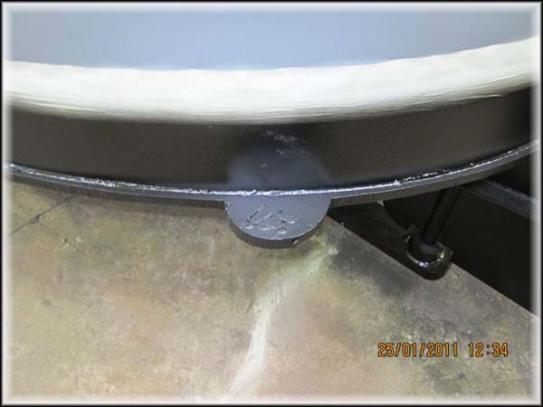
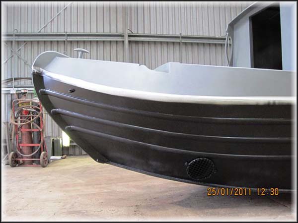
Having acquired this knowledge we included an additional step in Waiouru’s specifications.  There is one either side at the stern.

Hopefully no one will even have a need to use these steps to board Waiouru.  The other interesting thing to note in the photo is the thickness of the base plate which is twice the normal thickness. 

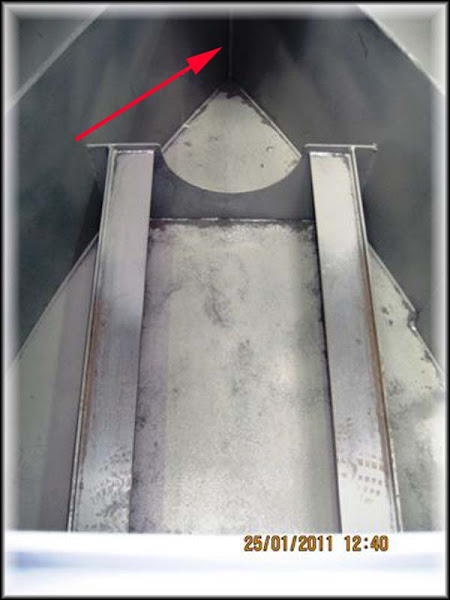
Same area of the boat but inside and you can see the bilge and engine mounting bracket.  At the moment there is no shaft for the propeller so at least we have some assurance Waiouru won’t sink :-) 

Sunday 30 January 2011

Porthole Symmetry

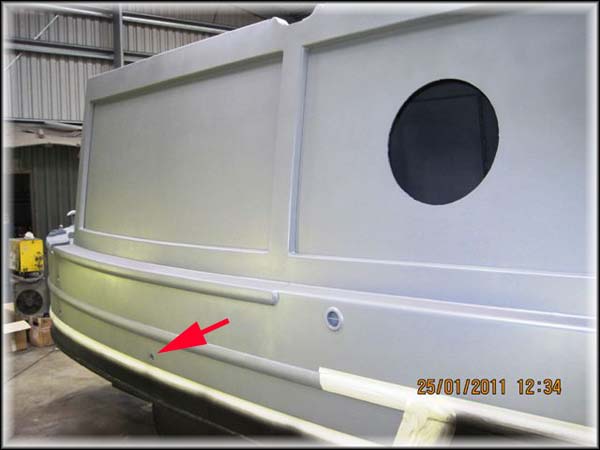
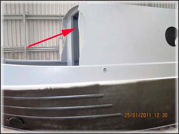
You may have noticed the location of the rear porthole in our previous post.  Here is the photo again.

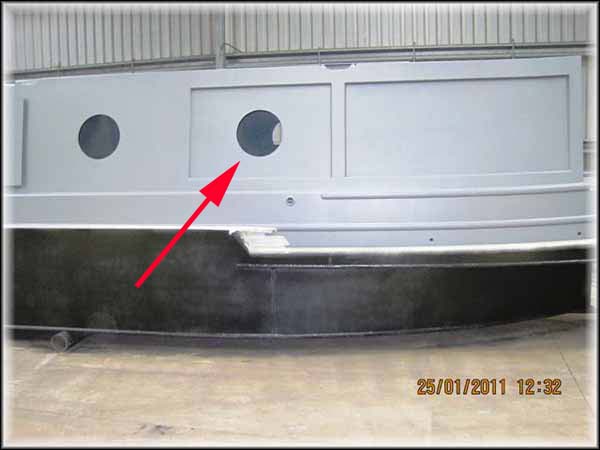
Tim Tyler has managed to fit the porthole in the centre of the smaller of the two recessed panels.  He managed to achieve the same effect on the port side as the following photo shows.

I’m really please he managed to do this as it’s something I hadn’t considered when calculating the location of the portholes.

My visit yesterday to the British High Commission Visa Section in Canberra went well.  I had a business meeting in the airport complex and as the Consular Office was only one kilometre away I took a stroll after the meeting to see if I could obtain answers to my questions.  The Consular was almost empty and as a result one of the officers kindly took the time to answer all my queries.  At the end of the meeting I told him I actually had all the necessary supporting documents with me and could I actually apply on the day.  He regrettably informed me they were closed for the day.  I thought it was rather good of him to give me some of his time on a day they were closed.

The result is that I will have to make an online application and credit card payment.  As part of this process I need to make a booking to have my biometric details collected (photograph and fingerprints collected).  Unfortunately this can’t be done in Adelaide which means I shall have to fly interstate to have the information collected.  I’ll probably make the booking in Melbourne as I’m likely to find the cheapest airfare on that route.  It will just be a one day round trip.  With the time zone change it will be another early start to the day.   I do have another business meeting in Canberra sometime in the middle of March, however this would not give sufficient time to have the visa application processed.

Saturday 29 January 2011

It looks Huge

When you look at the inside of the empty shell it looks huge.  However once fittings start being installed I can envisage it will rapidly start to shrink in size.

We have deliberately attempted to limit the number of internal partitions (there are only three) in an effort to give the impression of “space”. 

At the far (stern) end of the cabin there is a section that has no floor joists.  (not sure if this is the correct nautical term).  I’ve tried to magnify this area in the next photo, however the resolution has made it slightly out of focus.

The red arrow is pointing to the section.  This is where the underfloor blackwater tank will be installed.  It’s one of the reasons why we specified Waiouru was to have a 20mm thick base plate. The idea is we will free up more usable space inside the cabin by installing the tank under the floor.  There is nothing new in the idea but I didn’t realise that when I first thought of it!

Friday 28 January 2011

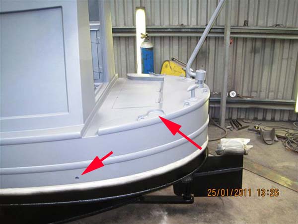
What are these holes?

I’ve noticed that there appear to be small indentations in the side of Waiouru and am trying to think of their purpose.  I can’t zoom in any further.  There appears to be two more further towards the stern and this time they are set one above the other.
There is something similar on the other side of the boat
The left arrow is pointing to it.  My guess is they might be water draining holes for the cockpit or perhaps vents for the rear gas locker.  This would explain the higher hole on the starboard side.  Can any of my readers confirm my assumption or tell me their real purpose.
The second arrow is pointing to the diesel filling point which has yet to be fitted.  There is one either side as there a two tanks at the rear (engine and central heater)

Thursday 27 January 2011

Waiouru is wearing her underwear

Overnight we received some photo’s of Waiouru from Andrew Phasey, our surveyor.  He had just completed a long car journey to visit Wilson/Tyler and view the progress that has been made since our last set of photo’s.  It looks like Waiouru is almost ready to be moved for the next stage in her fit out

When this photo was taken there was one final (3rd) full coat of two pack epoxy blackening to be applied and a 4th coat 6” wide either side of the waterline. 

The grab handles at the bow have also been now been fitted.

I has been a very long and tiring day so I will post more tomorrow.

Wednesday 26 January 2011

Plum Job

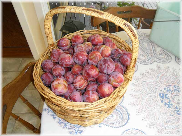
A few years ago our neighbour gave Jan a cutting off his plum tree which she duly planted and nurtured.  This year we had an early wet summer so we threw our net over the tree to prevent limit the amount of fruit lost to the birds.

We’re not going to be able to eat all of these before they “go off” and we have plenty of plum jam from our picking of the wild plums in the hills behind our house.  Jan has decided she will make plum chutney.  Should be interesting! 

Jan has been researching and recording simple cooking recipes for us during our life aboard Waiouru.  I consider this a '”dry run”!

Tuesday 25 January 2011

Reducing the Physical Size of the Video Data

As part of the boat minimalist plan I’ve turned my attention to reducing the physical size of of the video storage data.  My plan is to get everything onto two 2TB hard drives.

The first hard drive will go into the HDium Network Media Tank.  The tank can take a 2TB internal Sata II drive

Please ignore all my sticky fingerprints and dust.  The HDium is a rather plain black box with a card reader on the front.  Nearly all the input and output sockets are at the rear.  It has two internal TV tuner and capture cards which will enable us to watch one channel whilst recording another.  On the right side there is a rather unusual socket for an external Sata II hard drive. 

It’s not a real eSata socket but rather a quasi socket for a second internal Sata drive to be connected externally.  The HDium comes with a special cable to connect the second internal sata drive to the socket.  I didn’t want a naked internal drive sitting beside the NMT.  My solution has been to modify an old external hard drive case.  The power supply for it had failed which enable me to cut a hole in the end of the case.

This enable the special cable to connect to the sata drive I’ve installed in the case.

I’m now able to connect the external drive to the NMT.  This gives us 4TB of video and sound storage capacity.  Enough for approximately 8000 TV episodes.  I guess this will keep us amused on those miserable days when we don’t want to venture outside!

Monday 24 January 2011

Off to Canberra

Well it appears I may be able to visit the British High Commission in Canberra earlier than I thought.  Today I received a telephone call requesting I attend a business project meeting next Thursday and the meeting is just around the corner from the UK Visa Office.  There should be time after the meeting visit the visa office and confirm which of the many visa application forms I need to submit.  It’s unlikely I will have received my Australian passport prior to my visit which means I’ll need to make a second trip to submit my biometric details.

It will be a relatively long day for a reasonably brief meeting.  There is only one direct flight from Adelaide to Canberra and that departs at 6:30am, arriving in Canberra at 8:45am (allowing for the time zone change).  The is no direct return flight so I will need to return via Melbourne.  This will get me back to Adelaide at 4:00pm.  By my rough estimate the flying time will be approximately three times longer than the meeting.

The chief financial controller is a poor flyer so it’s rather fortuitous she is the one with the UK passport.   

Sunday 23 January 2011

A Change to the LAN Router on Waiouru

I wrote in my last post I thought I’d found a suitable wireless router from Solwise.  Unfortunately I received an email back from Steve Mace of Solwise advising the router would operate on 12v DC but it was no longer in production.
He offered the new 6500 as an alternative confirming it would also operate on 12v DC.
router 1
I wanted to check it would accept a usb dongle and did some further searching for photo’s.
router 2
I managed to find these two photo’s on another site.  You can see in the 2nd photo the unit has the following ports from L-R.  12v power input, 2 x ethernet out, 1 x ethernet in, 1 x usb port for the modem dongle. So it will meet our requirements.
I found the photo’s by googling “EnGenius”, the name of the manufacturer.  And I found their office in Acacia Ridge, Brisbane, Queenland.  Ironically, a few years ago I used to regularly visit Acacia Ridge on business.  However I won’t be purchasing one EnGenius.  The price from Solwise is much more competitive!

Saturday 22 January 2011

Wireless LAN on Waiouru

Google has been assisting me search for an internet solution to our data and international voice communications we will use on Waiouru. 
In a previously post I described how we have purchase a high gain external aerial to be fitted to the roof of Waiouru.  This means our modem must have an external aerial socket.  The MiFi looks a good option but it doesn’t have the external socket.  Searching around I found this site <clicky> which provides a comparison of the various dongles.  From this I have selected the Huawei E122.  It has the external aerial socket and a reasonable speed (7.2 Mbps down and 2.0 Mbps up).  It’s also dual band.  One can be purchased from ‘3’ which from what I’ve been reading generally provides the best coverage.
I don’t particularly want to plug the Huawei E122 into the laptop or the netbook as it will mean one of them will always need to be tethered to the dongle, which in turn is tethered to the aerial cable.  It would be preferable that the dongle connected into a wired or wireless LAN.  That way all the machines can access the network from anywhere in the boat. I’m specifically thinking of the laptop, netbook, iTouch, printer, eBook, Network Media Tank, etc).  Going down the wireless trail will give greater opportunity for expanding the network.
I’ve stumbled across the following device, <clicky> from Solwise.  It’s a small wireless router which will accept a usb dongle.  I’ve checked their website and the Huawei E122 is compatible.  The website mentions it operates on 240v AC but also mentions 5-12v DC so I’ve written to them asking if the router can be powered by 12v DC.  The device has a 2nd USB port and can take a webcam.  I’m thinking it might be possible to link the security module on the Empirbus system to the webcam and the wireless router so the security module could waken the webcam and send a live feed via the router and usb dongle to a mobile phone. 
Early days and only an idea!

Thursday 20 January 2011

Visa

It’s still early morning and yet you can feel the heat already.  Today is going to be a ‘scorcher’!  This morning the TV national news was showing a lovely sunny day in Brisbane city.  However the scene was deceiving as most of the shops were shut whilst they recover from last weeks massive flood.  Sadly the funerals for those who drowned during the flooding have also commenced.  And b*gg@er it!  The air conditioner has just failed.  The circuit breaker tripped and now there are no lights on the air conditioner control panel.  I’ve re-set the circuit breaker which has done nothing to resolve the problem.  I can feel a trip up onto the hot steel roof approaching!

We are guessing that by now Tim Tyler will have completed fabricating the shell of Waiouru so she should almost be ready to be moved to Ben Harp’s premises for fitting out.  When we started this project the delivery date was the end of February.  Somehow I can’t see that being achieved.

Oh.  The Visa!  I’ve looked at the UK website to check on visa requirements.  Goodness me; there are so many different categories of application to chose from.  And if you make the wrong choice you have to start again, plus you forfeit your application fee!  From what I can see the cost of the application is approximately $1500 so we won’t want to forfeit that!  It can take up to three months for the visa to be approved which means I’ll need to get the application lodged as soon as my new passport arrives. I also need to have my biometric information collected (photo and fingerprints).  Unfortunately this can’t be done in Adelaide which means I’ll need to travel to another State capital city for this to be done (more unplanned expense)! 

Wednesday 19 January 2011

Thinking Minimalist

Some readers may recall my earlier posting about converting all our DVD to AVI format and storing them on the hard drive of a Network Media Tank (NMT).  Doing this “crushed” them to one sixth of their original size and eliminated our requirement to carry a DVD library.  We then did something similar with our CD music collection.

The final piece of data was our reading material.  We both enjoy reading but don’t want to fill Waiouru with loved books that may have to be discarded when room becomes a scarce resource.

The solution has been eReaders.  I’ve been watching them for a few years and the functionality has increased whilst the price has reduced.  I actually managed to see my first eReader, a Sony, when our youngest returned from the UK with one. 

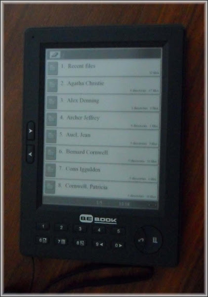
After researched a wide range of eReaders we have selected and purchased a BeBook by internet from the UK.  I looked carefully at both the Sony and the Amazon Kindle.  I didn’t like the latters file recognition formats which seemed too restrictive and I didn’t much like the idea of having to download by a wireless internet or mobile phone network connection.  The Sony seemed to be too expensive for the functions.  The BeBook was cheaper and will read a wider range of file formats.

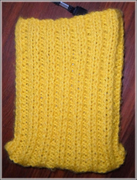
It doesn’t have a touch screen.  But then we don’t need the function.  It charges through the usb plug on the laptop and when fully charged it’s good for 20,000 page turns.  After using it for a few months I love it.  It’s particularly good on long flights as I’ve usually seen the in-flight entertainment on a previous trip.  I was concerned it might get damaged so I enquired about the cost of a cover.  Too damned expensive!  Jan has knitted it a cover.

No doubt this will keep it nice and warm on Waiouru during the winter months Smile

Tuesday 18 January 2011

Today we got serious about the passports

The office manager went on line and filled in the application forms for the two of us.  Fortunately she can remember all the important information (birth and, marriage dates, plus locations).  It didn’t seem all that painful an experience.  But then it wasn’t me who did all the work.  I’m no good at administration!  The next stop was the local post office to make an appointment for our ‘interview’.  The passport size photo’s we had previously purchased turned out to be unacceptable which meant delving into the purse (not mine) to get the credit card out for a new set of photo’s.  Then I had to find someone who was willing to admit they knew us and would sign the backs of the photo’s stating it was an accurate likeness.  Have you ever noticed how passport photo’s have two distinct qualities.  They make you look much older and give you a slightly sinister and criminal appearance.
Trevor kindly did the deed (Thanks Trevor) and we are now booked for our application interview at 12.30 tomorrow.  All the required documents have been carefully compiled by the office manager so I’m confident the applications will be accepted.  Once we receive our crisp new passports I’ll have to start the process of applying for a UK visa.  The Office Manager, Chief Financial Officer and Chairperson of the Board already has her UK passport!  I’m the foreigner!

Monday 17 January 2011

Canal GPS Data

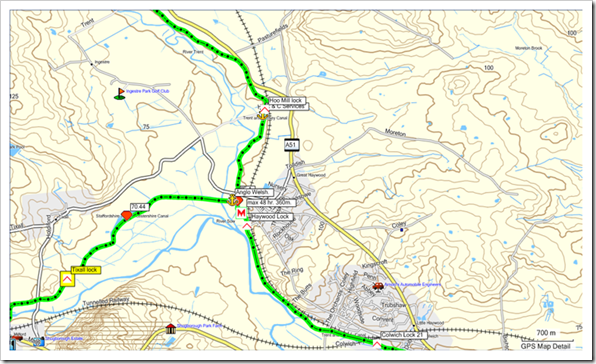
A few postings ago I wrote about setting up topographical maps in the Garmin Mapsource program so they could be transferred to our gps unit.  I’d also mentioned my Google Earth canal mapping project.  This is all starting to come to fruition and I’ve been able to import my first draft of canal routes and waypoints into the topographical map.  This following screen dump is the same location as my previous posting on the same subject.  But this time you can see the canal data.

image

One thing I have noted is the Garmin Mapsource program requires the name of every waypoint to be unique.  As a consequence it has re-numbered all the winding holes by adding a sequential decimal number to each.  The same has occurred with other duplicate names.

Sunday 16 January 2011

Google Analytics

Somewhat late with today’s post.  Just after midnight someone in the neighbourhood decided to turn on their stereo very loud and as a result we had a broken night.  Waking late I headed out on the usual Sunday morning walk.  However it was quite hot which made me rather lethargic.  Upon returning home I had to fix the pc which had decided it was taking a day off.  That took a further hour and I can now finally get the post completed.

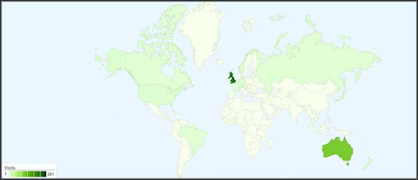
A couple of days ago Paul, from NB Lola, left a comment on our blog about our use of Google Analytics.   I must confess to being both fascinated and addicted to it.  The diversity of the statistics enthrals me.  Since setting up Analytics on 29 December last year it has reported a steady increase in traffic sources so that today we have 25.  We have received 574 visits from 17 countries. The majority of our readers originate in the UK, followed by Australia.  However visits have originated from as far afield as Tonga.  It has been a few years since I last visited Tonga.  An interesting island nation full of friendly people and fierce rugby players.

The Google Analytics Map Overlay

The top traffic sources are:

Visits                            No          % of total

Direct                           130       22,65%

nbsanity.blogspot.com   101      17.60%

benharpnarrowboats.co.uk 70     12.2% 

nbhumdinger.blogspot.com 51   8.89%  

blogger.com                     38     6.62%

I need to learn how to use more of the programs functions.

Saturday 15 January 2011

She shows us her derrière


Did any readers notice what a mess I made of the Picasa Web photo linkage in the initial edition of my last post?  No!  Great….. then I’m not saying anything either! 

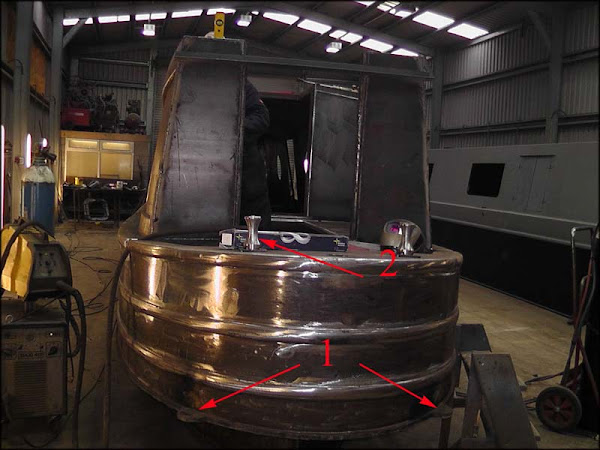
This is the last of our current batch of photo’s.   You can see the half round metal disc’s [1] we asked for mounted horizontally on the swim.  The idea is they can be used as a step to re-board Waiouru should someone decide to step off the boat before we reach the bank :-)  I believe the cylindrical anchor points [2] are know as “dollies”.  We specified “T” type anchor points so this will need to be discussed with Ben and Kelly.

It looks like we have a “lurker” hiding in the cockpit on Waiouru :-)  However the top of the yellow spirit level suggests it’s one of Tim’s valiant workers standing in the engine hole frantically beavering away to complete Waiouru for her anxious, excited, and demanding owners.

Friday 14 January 2011

More Photo’s of Waiouru


Another two photo’s.  This time I (hopefully) have taught myself how to place them into the blog by uploading the original photo from Picasa 3 on the pc to our web album and back to Windows Live Writer before it finally gets uploaded to the blog.

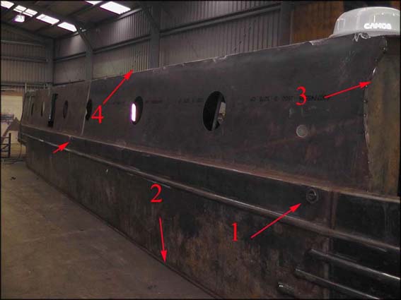
This is the Port (right) side of the boat.  The stern is to the left in the photo.  I’ve highlighted some features I’d like to mention.  The arrow 1 is pointing to the recessed anchor point we will use to secure the <thinking of the word……..> “Fender”.  There are three on each side just below the gunwale.

You may get a better idea of the thickness of the baseplate at arrow 2.  There are going to be hand grabs at arrow 3.  These will assist boarding and alighting at the bow.  Position 4 is the approximate location of the Camos sat-dome.  There are six 15” portholes and a side hatch.  From the front they are; main bedroom, bathroom, saloon (2), side hatch in the saloon, galley, and finally the back cabin.

Now for the second photo

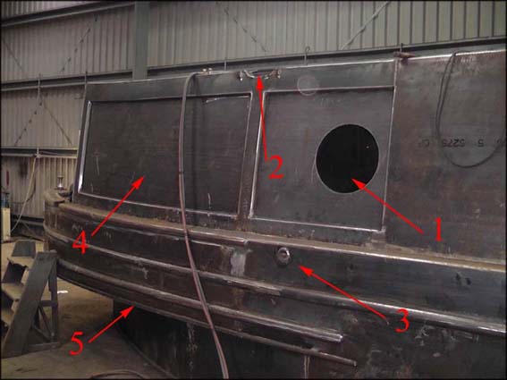
A large and small rebated panel are at the rear.  The smaller panel (arrow 1) has a porthole to provide light to the computer workstation which will be located inside. Arrow 3 points to the third fender mounting point whilst arrow 5 provides a better idea of the thickness of the baseplate steel.  Although I believe this part of the boat is named the “swim”.  Correct me if I’m wrong because I’m still coming to terms will the names of the various parts. The large panel (4) is where the boat name will go.  Finally, at arrow 2 there is a steel bean across the top of the boat.  It’s named the “boatman’s beam”.  The roofline handrail is cut away Immediately in front of the beam to create a gutter.  My assumption the beam not only provides some strength to the structure of the boat but also prevent water running the length of the boat before pouring into the open cockpit area.  I had noticed our hire boat didn’t have this beam and when we cruised in the rain water tended to pour off the roof onto the deck at the rear of the boat. 


Thursday 13 January 2011

We have some photo’s

Well until now the only images of Waiouru have been my own from Google SketchUp.  However that changed last night when Kelly emailed us photo’s of the shell taken during their visit to Wilson/Tyler on Monday

When I opened this first photo my immediate reaction was “This boat is “LONG and  very THIN!”.  Probably why they are referred to as narrowboats :-)

Boat 1a copy

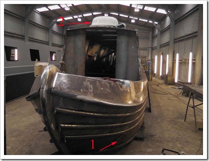
Arrow 1 is pointing at the grill over the “Girlie Thing”.  I understand that boats who don’t have this grill are the people that refer to it in this derogatory manner.  For those who do have the grill it’s referred to as the cover over the bow thruster tube. We asked for the grills at either end of the tube to prevent large foreign object jamming the impeller blades.  My thoughts are…. If the technology exists, will assist, and is cost effective, then do it!  I should also point out this is a cruising vessel and other more famous cruising vessels have both bow and stern thrusters.  We are in illustrious company!

You might just be able to see the thickness of the 20mm baseplate below the grill.  Tim mentioned to me in an earlier conversation the delay in starting was a problem in sourcing the material for the baseplate.  Most boats have a 10mm bottom.

The white object on the roof marked by the second arrow is our TV automatic satellite dome. I assume Ben took it along to see how it would look on top of the boat.  This isn’t our intended position for the dome.  It goes back along the roof just forward of the bulkhead (partition) between the saloon and the bathroom. 

Boat 2a inside 

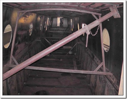
This is the interior of the 2x2 metres box steel culvert pipe we plan to live in.  Sometimes I have brief moments when I doubt our sanity.   If we wanted to; there are plenty of concrete culvert pipes in our neighbourhood where we could set up home.  There’s not all that much to see in this photo.  My assumption is the internal props and temporary bracing keeps all the steel plating aligned whilst the fabrication is completed.

Early days I think!

Wednesday 12 January 2011

What’s the status of the shell?

We had an email from Kelly before Christmas advising Tim Tyler had almost finished fabricating the shell.  Interestingly, we can’t be the only people who are curious about the situation as I received an email from Chris Wells on nb Belle enquiring about progress.

Well I made a couple of attempts to phone Tyler/Wilson from Australia late Monday evening our time.  no success on the first attempt; probably because I had my time zones mixed up and it was too early in the morning.  I managed to get through on the second attempt.  Whilst I could hear the conversation quite clearly it was apparent the connection at the UK end was very poor.  Consequentially we have not been able to obtain a progress report.

Chris has written about a problem with his Electrolux TravelPower unit in latest blog entry.  We did consider including a similar unit in our own boat specification but in the end opted for a very large domestic battery bank and inverter.  It remains to be seen if it was a wise decision.  Notwithstanding this, I am confident the combination of the battery bank and inverter is more than capable of managing our 240v AC requirements.

I wonder how many of our regular readers noticed our blog address has changed.  Yes, we have purchased (actually rented) a domain name and with a little help I’ve managed to link it to the blog.  The next step is to migrate the blog across to our own website.  Should be fun “stuffing” that up!

Tuesday 11 January 2011

A Sad Night

WARNING - There is nothing canal related in this post

Last night we had a bereavement in the house!

I was in the shower before heading to bed when electrical supply failed. After drying myself in the dark, dressing and finding the torch, I headed outside to see what had happened. It didn't take me too long to realise the ‘American’ had died.  She was only 10 years old, but had been in poor health almost since the day she moved in with us. Moreover, the cost of the doctor attending to her ailments increased on each occasions. The organ transplants were getting expensive.   I've decided there is no point in throwing good money after bad so there will be no further transplants or attempts at recuscitation.

She is rather large which means I will be forced to dismember her before I can remove her remains from the house. Fortunately, her predecessor, the smaller 20 year old "Kiwi" is still living with us in semi-retirement. I’ve already volunteered her to take over the American’s household duties.

So the moral of this story is "Don’t think that buying a large and expensive American made fridge/freezer is an indication of quality". We would have been better to stay with the little "Kiwi Battler" that has how been dragged from retirement.

Sunday 9 January 2011

Getting the UK Topographical Maps into the GPS

The Garmin Nuvi we purchased in 2005 came with the road maps of UK pre-installed.  They are great for driving around the UK but not much use for walking or on the canals.  This actually wasn’t much of a problem when the the Nuvi was the only gps unit we owned as it is only capable of navigating on defined roads.

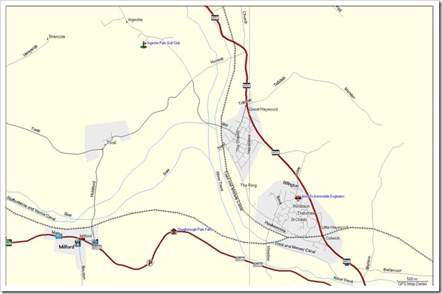
This screen dump shows the detail obtained using the maps from “Garmin City Navigator”

City Navigator UK Map

The situation changed with our purchase of a Garmin Oregon 550 gps in 2009.  It is a multi-purpose gps and can use topographical maps.  You can purchase the Garmin Topographic series for the UK however it much more fun installing non standard maps.

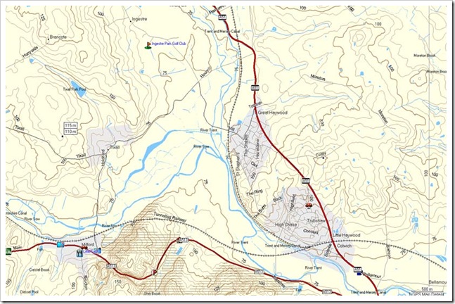
This screen dump shows the level of map detail from the Scottish Mountain Club topographical maps of the UK

GP Topo Map

Exactly the same location, however there is considerably more terrain detail in the second set of maps.  Notice how the watercourses are more accurately portrayed in the terrain map.

So how did I install the free maps?  Well actually it was very easy and this is how I did it.

I downloaded a complete set of free topographical maps from the Scottish Mountaineering Club (SMC) <click here>.  On unzipping them I discovered they were in IMG format.  I now needed to compile all the IMG files into one file and load it into Garmin Mapsource.

This was done by placing all the unzipped files into one folder.  Make sure the *.TDB file is included.  This latter point isn’t critical but it makes the process easier.

Download a copy of MapSetToolKit V1.77 <here>.   Unpack and load it.  The instructions for using the program to compile and load the maps into Garmin Mapsource are here <clicky>.  Note; some problems with using MapSetToolKit in combination with Mapsource have been reported.  However I used MapSetToolKit v1.77 without a problem.

Once you have installed all the maps into Mapsource you can transfer all (or some) of them to your Garmin gps using the standard method.

The SMC maps provide me with a much better set of topographical maps by having the contour lines which I so desperately wanted.

Experimenting with the Oregon 550 GPS

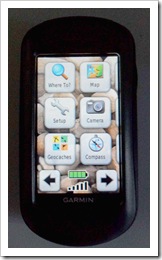
When we purchased the Garmin Oregon 550 in Sheffield back in 2009 it came without maps.  I’ve been playing around with it ever since.  The first thing I did was add an 8GB micro SD memory card.  This gave me plenty of room for storage and the ability to double the  maximum number of map sets the gps could hold from 2 to 4.  I also worked out how to add some personal details to the the start-up screen.

gps2

My name, location and mobile phone number

gps4

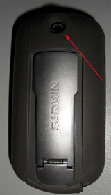
The 3.2 megapixel lens for the camera is on the reverse of the unit

gps3

This is the first screen in topographic mode.  The other modes in the unit include marine and automotive.  I’ve yet to try the marine mode, however the automotive mode does work.  It has no speech function; so unlike our Garmin Nuvi there are no voice “turn by turn” instructions.  Instead the Oregon “beeps”

gps1

The next thing I should do is explain how I loaded the free topographical maps onto the unit.

Saturday 8 January 2011

Removing the ‘Atom’ Subscription Link from the Blog

At the bottom of my blog page there is (was) a subscription link to ‘Atom’. From my “googling” around it appears to be an alternative to the RSS feed and icon I had already placed on the blog.  I thought it might be confusing for readers to see two subscription options and decided to remove it.  After a few minutes searching on Google I found some instructions <here> on how to remove the ‘Atom’ link and free up some space at the bottom of the blog.

Well it’s now gone and the blog didn’t “crash” <phew>!  (note to myself) Learn how to make a backup copy of your blog because you know you like to “tinker around” and in your ignorance you will eventually corrupt the coding!

Friday 7 January 2011

Making Sense of the Map Icons

I’ve imported all my Google Earth canal information into Garmin Mapsource to discover that the waypoints are displayed using a standard black icon that looks somewhat like the numeral 1 with a flag.  However, when I downloaded the gps coordinates of the various businesses the information frequently came with a small coloured icon.  Until now I’ve not been able to display this icon in Mapsource.

Last night I worked out how to make and display customised icons in Mapsource.  They must be placed in a special folder located here:

C:/Documents & Settings/[my login name folder]/My Documents/My Garmin/Custom Waypoint Symbols/[symbol #].bmp

The symbols must have a filename that is a number and be in BMP format.  You can use numbers 01-99.  I renamed all the icons I’d downloaded and placed them into the above folder.  <trumpet call> they appeared in the Custom Icon area in Mapsource.

The next thing I needed to do was design symbols for canal features (locks, services, winding holes, etc).  The icon needs to be no more than 16x16 pixels.  If I thought I was a bad photographer then I’m a much worse graphic designer.

06202831

Three of my icons - ‘Moorings’, ‘Lock’ & ‘Boat Facilities’

I now have the customised icons in Mapsource and have commenced the process of associating the icons with the canal waypoints.

Thursday 6 January 2011

Additional Waypoints

It’s possible to download from the internet various categories of waypoints.  For example; most major UK supermarket chains will provide a file with the location of all their stores.  Sometimes this information is obtained in the Garmin format and on other occasions it may just be the latitude and longitude coordinates with some additional information such as a name or telephone number.

In many cases it is possible to convert waypoint information to the Garmin format.  Usually I use GPSBabel during this process. If the data can be converted to a plain text file then it can be pasted into Excel.  I then save the Excel file as a CSV file.  This can be converted by GPS Babel to Garmin gdb format and then imported into Mapsource.  Another option that can be used with Google Earth is to save the waypoints from Google Earth as a kml file.  GPS Babel will convert this to Garmin gdb format.

One early mistake I made was failing to recognise some of the downloaded files had their latitude and longitude coordinates in reverse sequence.  I converted the file using GPSBabel and imported the waypoints into Mapsource but nothing appeared.  Then I repeated the process with the same result.  None of the waypoints were in the UK.  By chance I increased the scale and found the waypoints in the middle of the Indian Ocean!  That’s when I realised the sequence of the coordinates had been reversed.  To rectify the problem I converted the coordinates to a CSV file and imported them into Excel.  It was then a simple case of reversing the column sequence and re-saving the file as a CSV before converting it back to a gdb file.

What waypoints are available?  For the UK….. quite a number.  I now have the locations of all the major supermarket chains, B&Q, Screwfix, fast food outlets (for the wifi!), petrol stations, red light camera, public toilets, police stations, TIC offices, attractions, the list goes on. 

Wednesday 5 January 2011

Getting the information into the Garmin GPS

Effectively my Oregon gps unit contains four types of information; maps, routes, trails and waypoints.
Maps are usually purchased.   However it is possible to obtain legal copies of free maps.  It is even possible to produce your own maps.  My maps are a mixture of purchased and free.  I have purchased copies of Garmin City Navigator Western Europe and Australia. Both of these series of maps are used for vehicle navigation.  I have also downloaded a free version of the road maps of New Zealand.
The City Navigator (CN) series of maps from Garmin do not have the detail required for terrain navigation.  They don’t contain the required level of detail such as contour lines.  It is possible to purchase topographical maps from Garmin however there are also some good free (open source) maps available. I have therefore installed onto the Garmin Oregon a set of the “Shonky’s” contour line maps for Australia, and for the UK, I download and installed a set of the topographical maps of the UK from the Scottish Mountain Club website.
To get the maps onto the Oregon I first needed to install them into the Garmin Mapsource program.  From there they can be transferred to the gps.
Routes are calculated using the City Navigator maps.  The user selects the origin and destination and Mapsource identifies the preferred route.  The route can then be transferred from Mapsource to the gps.
A waypoint is a fixed point on a map.  It is usually named and almost certain to belong to a category.  The Garmin (CN) series come with many predefined waypoints.  Examples are, accommodation, post offices, banks, pubs, supermarkets, etc.  It is also possible to create your own waypoint categories.  For my canal maps I’ve created categories for locks, waterpoints, winding holes, marinas, etc.
Tracks are essentially a series of waypoints linked together to form a trail. Tracks can be created in Mapsource and transferred to the gps.  Our Oregon gps has a “breadcrumb” function which enables me to record a track as I walk it.  This can then be saved an uploaded into Mapsource.  It is also possible to view the Mapsource information in Google Earth.  However it is slightly more complicated to view Google Earth waypoints, routes and tracks in Mapsource.  I’ll leave that for another post.

Tuesday 4 January 2011

The Big Flood

The situation unfolding in Queensland might be considered astonishing if it wasn’t so tragic for those affected. 

So much rain has now fallen in such a short period of time that an area the size of France is now under water.  The area of affected land is so vast and flat that it can take weeks for the water to slowly flow to the coast.  Inland properties are starting to appear from beneath the water, however further towards the coast the water levels continue to rise.  Hundreds of homes have been inundated, some up to the eves, and for some poor souls it’s the second time this has occurred in as many months. The city of Rockhampton on the coast is now cut off by road and air.  The cost of the flood damage has been estimated in the billions.
We have already being warned the price of fruit and vegetables will rise nation-wide as demand places pressure on a reduced supply.  No doubt the same will occur with building products and home furnishings.  Whilst the rest of the country hasn’t been directly affected by the flooding I envisage our next insurance premium payments will see a substantial increase.

Here in Adelaide we have recently exited a declared period of “catastrophic” fire danger.  The hot weather has made everything tinder dry.  Police were out checking on the activities of known arsonists and all the forest and conservation parks were closed to the public.

It’s amazing to see the extremes in climate when living in the same country…….. or should I write… continent!

Being stuck in ice on a canal in the middle of an icy winter is actually starting to seem like a more pleasant situation.  <stop>   I may live to regret that sentence!

Testing the Garmin Oregon 550 GPS

After a couple of very hot days the temperature dropped to 30c today which provided me with the opportunity to get out on a long walk.

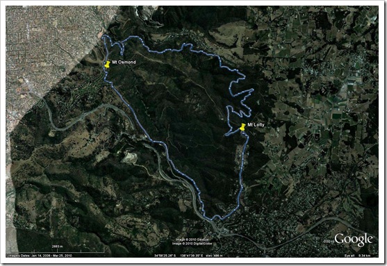
I mentioned in a previous post the work I’d been doing with Google Earth and how I intended to use the “bread crumble” function in the Garmin gps.  This is a screen dump from Google Earth showing the route I took today when walking in the Mount Lofty Conservation Park. The route was uploaded from the gps to the Garmin Mapsource program on the pc and transferred from there into Google Earth.

Mt Lofty Walk 

In the upper left corner is the edge of Adelaide city and my route is shown by the thin blue line.  The line actually consists of hundreds of waypoints.  I’ve set the Garmin Oregon gps to record a waypoint every 10 metres.  I started at the top left corner and walked in an anti-clockwise direction.  The route took me on to Mt Osmond, then “Eagle on the Hill” to Crafers (bottom right) before heading up to the high point at Mt Lofty summit.  I then made my way back to the start point covering approximately 20km at an average speed of 6km/h.

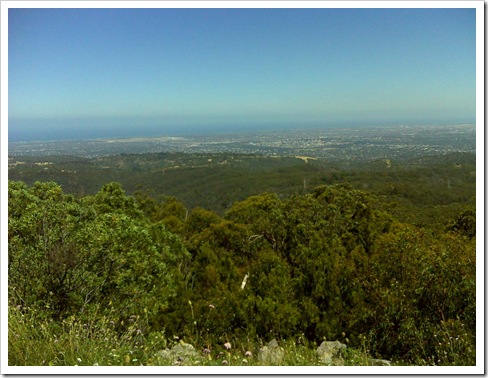
This is the view from Mt Osmond looking west towards the centre of Adelaide city.

Mt Osmond

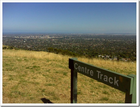
This next photo is from the Mt Lofty summit. Again looking west towards the city and gulf.

Mt Lofty

Both scenic photo’s were taken using the camera in the gps.

The gps has a function that enables the user to link a photo to a waypoint.  I need to learn this function as it may prove useful on the canal.

Monday 3 January 2011

Navigating the Network

I spent much of Christmas and New Year in front of the computer hiding from the heat.  My eyes are red and sore from peering at the detail on the monitor as I traced the canal network in Google Earth.  Actually I’m correcting my earlier attempt and also adding more detail to the maps.  Things that will be useful; like water points, service facilities, locks and marinas.  Most of this information has been obtained from various sites using Google.  I now need to think about finding a source for telephone numbers.  The Yellow Pages are going to get a thrashing!

It’s unlikely we will actually use Google Earth as our primary means of navigation.  It would require frequent internet access which may not be available.  Instead, I will convert the Google Earth canal data from kml format into Garmin Mapsource format using GPSBabel.  I will then be able to transfer the data from Mapsource to our Garmin gps unit.  This will provide us with a “live” progress report as we travel.  Another advantage to this approach is the Garmin gps unit has a “breadcrumb” function which will enable me to correct my original Google Earth trace.

Sunday 2 January 2011

The Banner

I was looking at the design of the blog yesterday when the text on banner hit me.  “A photo will be posted when construction starts”.  I suppose I can write that construction started last year (LOL).  Apparently the shell is almost finished.  Actually it probably would be finished if that damned fat guy who wears red pyjamas hadn’t arrived and sent the workers home!

However I must remind myself; I would not like to be working in freezing conditions fabricating steel plate. Nevertheless, one must be optimistic; so I’m anticipating we will have a photo to post within a week (or two). 

Saturday 1 January 2011

Google Analytics

Well, two days ago I configured Google Analytics to work with the blog and despite the program telling me I’d see statistics within 24 hours it didn’t happen.  Eventually worked out why……..  I’d failed to configure it correctly.  A simple oversight on my part which was easily rectified. 

Today I looked at my first report.  To my surprise I discovered other canal boaters had found my blog and had already placed my blog address on their blog list.  After three months of quiet blogging we’ve been “outed”!         Back to Google Analytics.

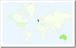
There is an interesting map which shows where our viewers originate

analytics map 

23 from the UK

8 from Australia; and

1 from the USA

Of the 32 'visitors 26 are unique.  I guess that means once during the 24 hours.  Actually, I might be wrong.  It’s once during the previous month.  But then the clock has only been running 24 hours!

The source of the traffic to the blog is interesting

Sources

Visits

% visits

(direct) ((none))

9

28.12%

benharpnarrowboats.co.uk (referral)

3

9.38%

blogger.com (referral)

3

9.38%

boatersblogs.blogspot.com (referral)

3

9.38%

google.com.au (referral)

2

6.25%

Three have come via our boat builders website (Ben Harp Narrowboats).  Three from other bloggers sites and three from Sue of “No Problems” website.

Delving into this a little deeper I can see some readers have arrived via the following blogs

nbhumdinger.blogspot.com

 nbsanity.blogspot.com

nbwillawaw.blogspot.com

pickles-no2.blogspot.com

coobeastie.co.uk

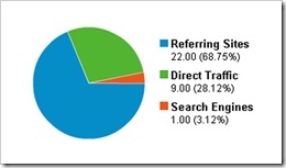
There is a pie chart which provides a summary of the referrals

pie chart

I think I’m getting addicted :-)